• Welcome to the new NAXJA Forum! If your password does not work, please use "Forgot your password?" link on the log-in page. Please feel free to reach out to [email protected] if we can provide any assistance.

#16a Saddle Up - News and Updates

If you need to meet up with someone I'm sure Scott and I can meet up with you. Where you located at?
He's on the west side.. me and you can roll out together, and call him when we reach the tunnel. he can just hop on the freeway at the same time and we can catch up via CB
 
Spike we can meet you at the gales creek gas station too if u want ? Rogers is easy though. Its the first turn off, where the ODOT gravil barns are. its a cpl miles before the turn off to get to Lyda where we camped Thanksgiving weekend.

oops. didnt see Dustin started a new thread for this run.

End thread jack...
 
Spike we can meet you at the gales creek gas station too if u want ? Rogers is easy though. Its the first turn off, where the ODOT gravel barns are. its a cpl miles before the turn off to get to Lyda where we camped Thanksgiving weekend.

oops. didn't see Dustin started a new thread for this run.

End thread jack...

Now it's not a full thread jacking though, this run did start out for getting the signs up for the trail. Now that is something about the trail adoption lol
 
Success!

IMG_0006.jpg


We got the signs hung on Saturday, and ran the first section of trail. Nothing looked like it needed attention.
 
1/2/10 -

We've had some hard rain recently which melted off most of the snow. As a result the trail has some ruts developing. The ruts aren't really a problem, but the drainage on the exit below the hill climb is. The ruts are diverting the runoff from reaching the ditch.

IMG_0018.jpg


There is a waterbar just above the road. I think the simple solution will be to dig it out, and create a good slope into the ditch.
IMG_0019.jpg


I believe it can probably wait until spring. Lets keep an eye on it, and if we need to we can always clear a path into the ditch. I keep thinking we'll get a good snow pack on the trail, but we haven't.
 
Yeah that looks a little nasty there. I'm sure it is going to get worse before it gets better. Might be best to wait till the wet season is over so we don't have to fix the same problem twice.
 
2010 ODF work party dates are out.

March 27: ATV/Bike/4x4 Trail Maintenance & Assessments

April 10: ATV/Bike Trail Project
April 17: SOLV Day Clean-Up
May 8: 4x4 Trail Project
June 12: ATV/Bike Trail Project
September 11: ATV/Bike/4x4 Trail Projects
October 9: 4x4 Trail Project

Dates that are in bold, are the ones I would like us to try and attend. Definitely the March 27 event to assess the trail, and the April 17 SOLV clean-up. Aside from those two events I'm flexible on any other work parties for the year.
 
im not shure looking at your pics dustin. if a simple dig out will work on this side of the trail.it takes alot of runoff it looks like. we may want to look at making it a off camber entrance so that the flow would be redirected, twards the low side. just at thaught, i know we talked about off camber anyway in the begining.

thx
Bronze.
 
It's been awhile but we haven't forgotten about our trail. Rod, Dave, and I ran it two weeks ago, and it survived the heavy rain pretty well.

There has been some activity going on in the quarry next to the hill which concerned me as they were getting pretty close to the trail. I just got a email back form ODF, and they needed some pit run gravel for some logging activity. Supposedly they are done blasting away from the hill and will be working there way down the hill. After this run, there should be no more activity for awhile, so the the trail is safe for now.

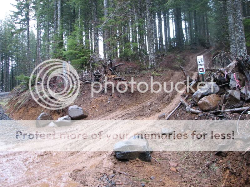
Also, ODF will be getting some equipment up there to fix the ditches and beef up the water bars (see above pictures). I'll let you guys know when I find out a date. Maybe a few of us could head up and lend a hand.
 
Hello, most of you do not know me, my name is Matt. I am a Forestry student at Centralia College.

Some have mentioned a need to create a good working map of this trail/trail system. Well, I am learning to use ArcGIS right now and I have my own copy of the software (retail about 15k). Meaning, with the proper data I can build a map to suit your needs.

Most likely, I can source nearly all of the required data from free online sources. I would however need some good GPS datapoints from the actual trail. If anyone has a better quality GPS unit that they know how to use and how to export a saved track from I could help make a map for your trail.

Let me know what you think...


Thanks
Matt
 
Thanks for the update Dustin! Never knew about that trail being taken care of by Naxja. Cant wait to get out and help!
 
I can grab a pretty decent GPX/kml/csv file next time I'm up there.

Dustin, thanks for the update.

Let me know the specific requirements you guys want for your map as well as some Lat. Long. coordinates for the area so I will know what data I need to find. I am not familiar with this area so if there is anyone who would like to be my go to answer person that would be capable of defining the requirements and specifications of the map that would be a great first step.

Thanks
Matt
 
I'm hoping to hear back from ODF when they will be going in with their equipment for some water bar and ditch work. At the very least though I would like to get up there sometime this fall before winter sets in.

Shovel and pick work can go a long ways, but an hour or two with a machine would be best. I know the waterbars at the entrance and exit of the first section need beefed up, and there's one water bar/corner on the trail that could use some work as well.

I'm sure we'll run it next weekend, and we can try and nail down some ideas to relay back to ODF.
 
I would be down for a TSF scout run on Saturday, I would get to test out the mods to my XJ. Sunday I cant make it, Tuff Trucks at the Clark County Fair!! Maybe do some GPS mapping as well?
 
Back
Top