NW99XJ
NAXJA Forum User
- Location
- Gresham, Or.
First let me say thanks to AwesomeXJ and Mopar440 for coming out, and working so hard. Both great guys, and obviously are as passionate as I am about this project. Special thanks to AwesomeXJ for coming out of pocket for the cost of the marking materials, we couldn't have acomplished what we did without them.
>
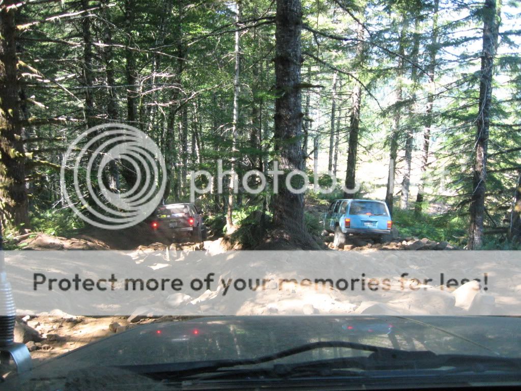
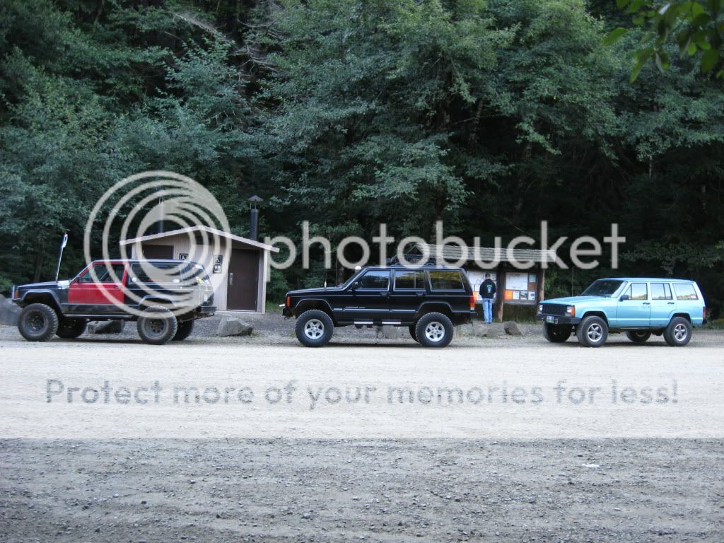
Aaron and I met up at the McDonald's in North Plains, had some grub, and hit the road. No sooner did we get passed the on-ramp and we see this teal Cherokee up in the distance, we caught up and low and behold it was Keith. We caravaned up to the Shell station where they topped off the tanks, and got some grub and we all made our way up to Rogers...
There were some inmates cleaning out the latrines there, and of course an ODF worker, so we briefly asked if he could verify if the Beaver Dam Rd. closure was still in effect, he radio'd in and it appeared as if we were in the clear, so we made our way all the way up to Saddle Up.
We brain-stormed for a little while, decided we'd use the Orange flags Aaron brought to mark the center line, and the pink ribbon to mark the outer edges of the proposed new trail path.
We then got right to work.
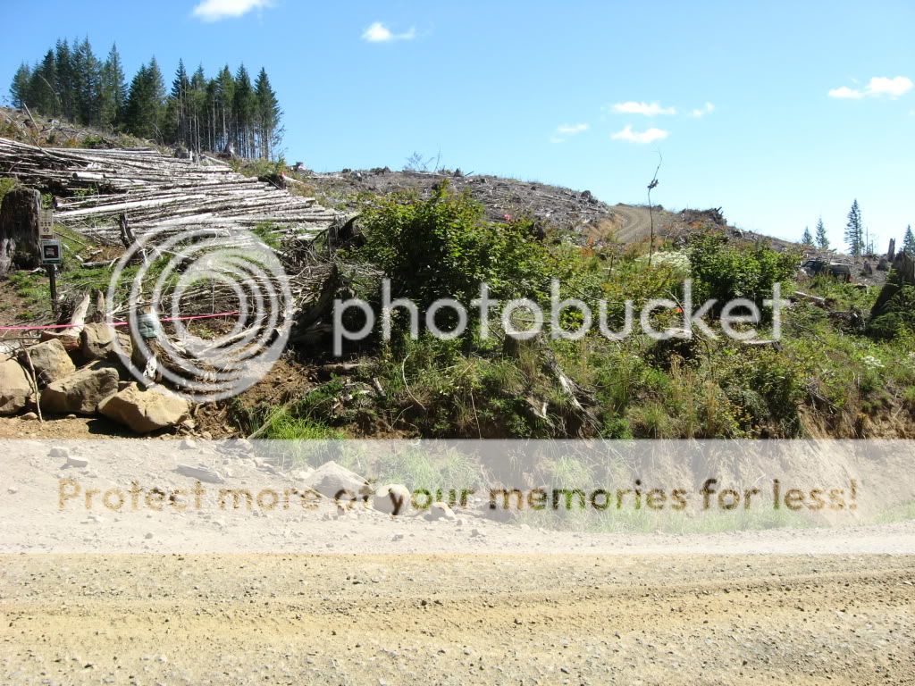
We picked this location for the new gateway into Saddle Up. (see the little Orange flag on the stump? its right of center in the pic...)
That'll be the new entrance.
You can see the old trail entrance to the left.....In the video I took -see below- I started from that stump, (so keep that in mind.)
We'll incorporate some sort of width/capability filter into this spot when the construction actually begins.
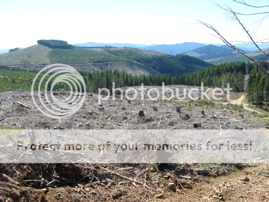
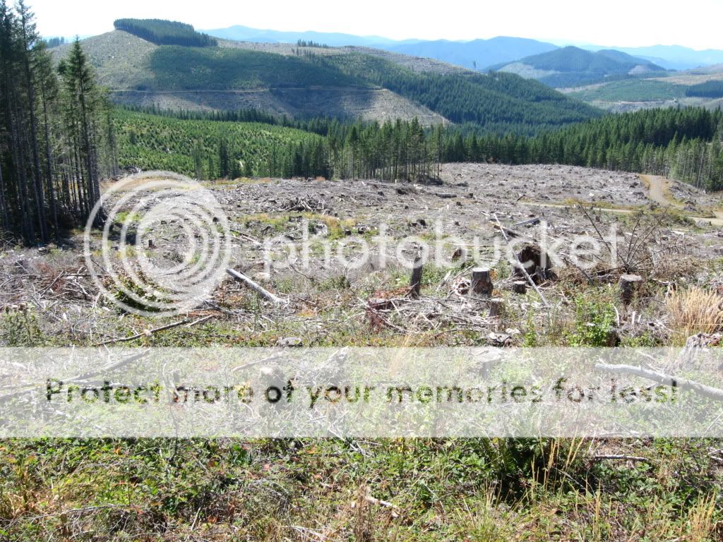
This is looking into the area that will be the first stage of the new trail. This is taken from 2/3 of the way up the old trail, looking in towards the new first section.
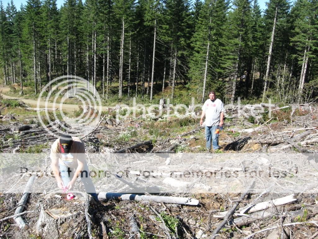
Aaron all day was a consummate leader, giving and taking advice, criticism, ideas, and working just as hard as Keith and I, here you see him eye-balling sight lines and surveying the lay of the land, or maybe he was just hungrily looking at Keith's ass:
We made our way up and across the natural grade of the hill side, taking advantage of the stumps as boundary markers, zig-zagging our way to the central part of the area you saw in the third picture, thru and around stumps, over hillls and burms. There in the middle of all that, we have designed what we think will be the main obstacle we're building into the trail, making it a new destination spot in the TSF, you'll see it in the video, and I'm sorry I didnt take as many pics as I would have liked, but the video will explain it all.
In a nutshell it'll be a two-line face or hill climb. The face climb portion is a zig zag entrance to a sheer face between two large stumps, when its done it will rival Waterfall. The hill climb line will be to the right of that and will be less intimidating, but still quite hard, Both will join together in a flatter area where there will be enough room to turn around, or for two way traffic. (...we're also talking about making a loose rock bypass that will be in no way a walk in the park, closer to the road from all of this that will join into the next portion of the trail.....)
The trail narrows again, angles slightly down (to join in with the aforementioned bypass) then back up again thru more stumps, and over a slight hill before you come down and curve around to enter the wooded area.
This pic is looking down into that section - the wooded area is to the left:
The wooded area offers excellent shade, and is sure to be a destination spot for those who want a good place to break for a while and eat lunch or just get out of the sun. From there you'll continue on to what will be the most challenging length of sustained hill climb on the trail. The grade is at least as steep as the old trail, of not more so. There will be off camber spots, and a couple slight turns to prevent a balls out skinny pedal run to the top. We've planned to tie into the old trail up at the top - roughly at the 1/2 way point - of the ridge line, where we discussed the possibility of making the rest of the run a rock garden of sorts. Similar to what you will find on the top of Hogsback. 1'-2' diameter rocks tightly packed into a small field (100 yards long maybe...) from there you will exit the trail thru another filter.
This will conclude phase 1 of the build, the next phase will be to delete the exit road, move the quad/bike trail tie-in back another 50 yards or so, and cut more Saddle Up thru the woods to tie into Firebreak 5. That will be done at a later time however. The focus right now is getting this section done and open.
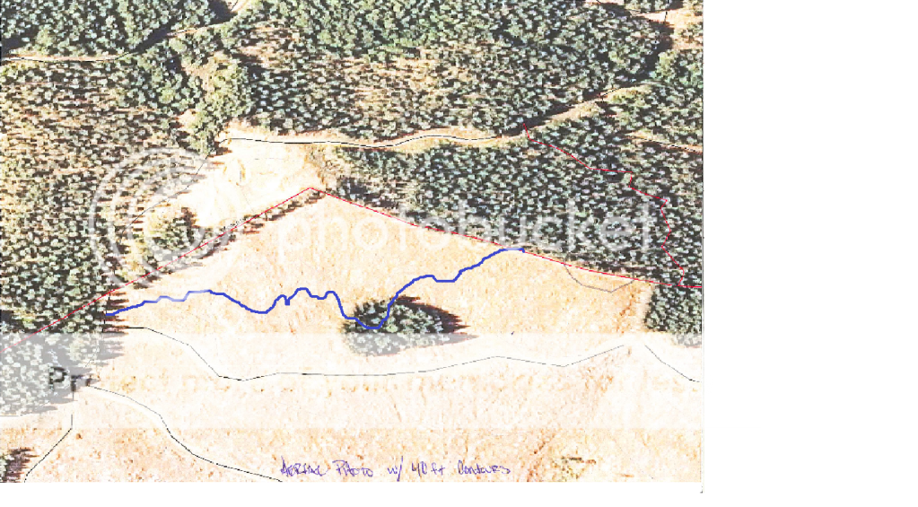
Here is an aerial photo with a VERY rough estimated sketch of how the new phase1 of Saddle Up will be routed. (dark blue bold line)
Once we were done flagging and marking, we walked back along the ridge line, dodging overly aggressive horse-flys, and stopped to survey the rock quarry. (trust me thats a looong way down)
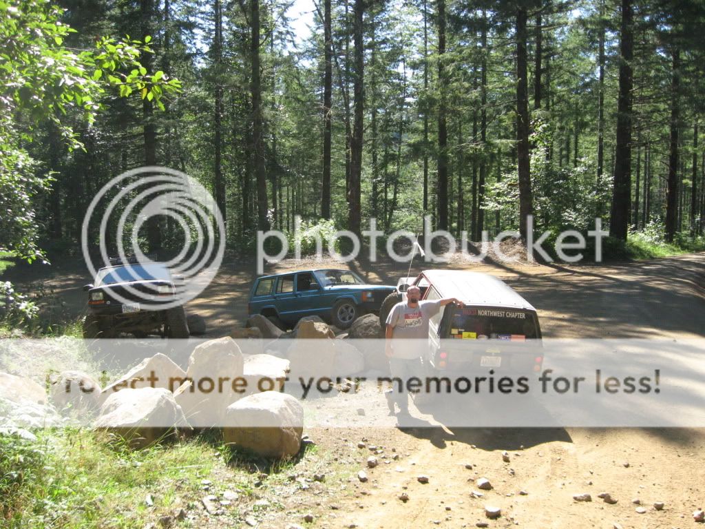
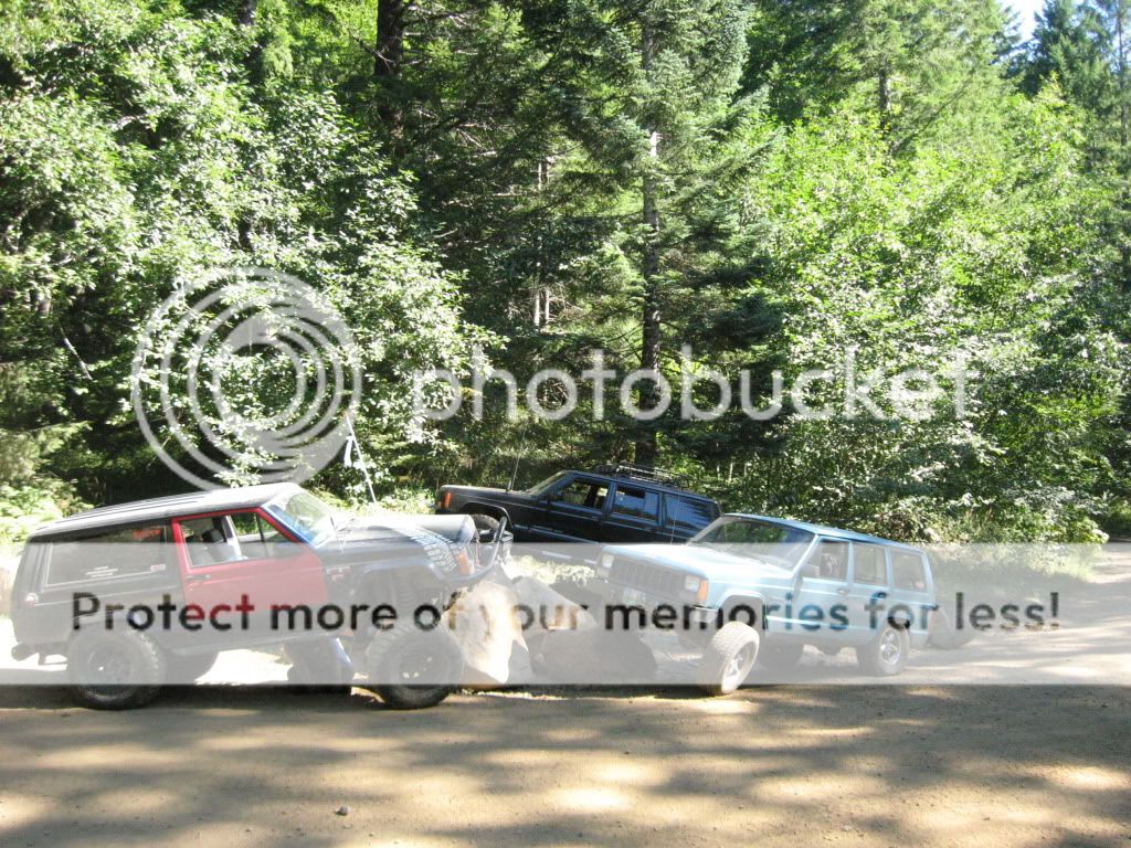
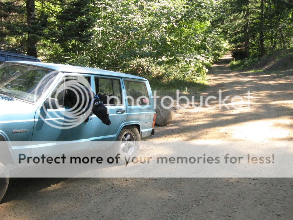
We continued down the old hill climb where Aaron and Keith grabbed their rigs and headed into the woods for a well deserved late lunch break.
I however, in the spirit of wanting to share our work with all of you... decided to RE-HIKE the whole new trail, in its entirety, and film it, to give you at least somewhat of a visual reference of whats to come.
My camera isn't the best, and footage never does the real thing much justice, but here it is none the less.
http://youtu.be/vHZVyzUiAZM
>
Aaron and I met up at the McDonald's in North Plains, had some grub, and hit the road. No sooner did we get passed the on-ramp and we see this teal Cherokee up in the distance, we caught up and low and behold it was Keith. We caravaned up to the Shell station where they topped off the tanks, and got some grub and we all made our way up to Rogers...
There were some inmates cleaning out the latrines there, and of course an ODF worker, so we briefly asked if he could verify if the Beaver Dam Rd. closure was still in effect, he radio'd in and it appeared as if we were in the clear, so we made our way all the way up to Saddle Up.
We brain-stormed for a little while, decided we'd use the Orange flags Aaron brought to mark the center line, and the pink ribbon to mark the outer edges of the proposed new trail path.
We then got right to work.
We picked this location for the new gateway into Saddle Up. (see the little Orange flag on the stump? its right of center in the pic...)
That'll be the new entrance.
You can see the old trail entrance to the left.....In the video I took -see below- I started from that stump, (so keep that in mind.)
We'll incorporate some sort of width/capability filter into this spot when the construction actually begins.
This is looking into the area that will be the first stage of the new trail. This is taken from 2/3 of the way up the old trail, looking in towards the new first section.
Aaron all day was a consummate leader, giving and taking advice, criticism, ideas, and working just as hard as Keith and I, here you see him eye-balling sight lines and surveying the lay of the land, or maybe he was just hungrily looking at Keith's ass:
We made our way up and across the natural grade of the hill side, taking advantage of the stumps as boundary markers, zig-zagging our way to the central part of the area you saw in the third picture, thru and around stumps, over hillls and burms. There in the middle of all that, we have designed what we think will be the main obstacle we're building into the trail, making it a new destination spot in the TSF, you'll see it in the video, and I'm sorry I didnt take as many pics as I would have liked, but the video will explain it all.
In a nutshell it'll be a two-line face or hill climb. The face climb portion is a zig zag entrance to a sheer face between two large stumps, when its done it will rival Waterfall. The hill climb line will be to the right of that and will be less intimidating, but still quite hard, Both will join together in a flatter area where there will be enough room to turn around, or for two way traffic. (...we're also talking about making a loose rock bypass that will be in no way a walk in the park, closer to the road from all of this that will join into the next portion of the trail.....)
The trail narrows again, angles slightly down (to join in with the aforementioned bypass) then back up again thru more stumps, and over a slight hill before you come down and curve around to enter the wooded area.
This pic is looking down into that section - the wooded area is to the left:
The wooded area offers excellent shade, and is sure to be a destination spot for those who want a good place to break for a while and eat lunch or just get out of the sun. From there you'll continue on to what will be the most challenging length of sustained hill climb on the trail. The grade is at least as steep as the old trail, of not more so. There will be off camber spots, and a couple slight turns to prevent a balls out skinny pedal run to the top. We've planned to tie into the old trail up at the top - roughly at the 1/2 way point - of the ridge line, where we discussed the possibility of making the rest of the run a rock garden of sorts. Similar to what you will find on the top of Hogsback. 1'-2' diameter rocks tightly packed into a small field (100 yards long maybe...) from there you will exit the trail thru another filter.
This will conclude phase 1 of the build, the next phase will be to delete the exit road, move the quad/bike trail tie-in back another 50 yards or so, and cut more Saddle Up thru the woods to tie into Firebreak 5. That will be done at a later time however. The focus right now is getting this section done and open.
Here is an aerial photo with a VERY rough estimated sketch of how the new phase1 of Saddle Up will be routed. (dark blue bold line)
Once we were done flagging and marking, we walked back along the ridge line, dodging overly aggressive horse-flys, and stopped to survey the rock quarry. (trust me thats a looong way down)
We continued down the old hill climb where Aaron and Keith grabbed their rigs and headed into the woods for a well deserved late lunch break.
I however, in the spirit of wanting to share our work with all of you... decided to RE-HIKE the whole new trail, in its entirety, and film it, to give you at least somewhat of a visual reference of whats to come.
My camera isn't the best, and footage never does the real thing much justice, but here it is none the less.
http://youtu.be/vHZVyzUiAZM
Last edited: