• Welcome to the new NAXJA Forum! If your password does not work, please use "Forgot your password?" link on the log-in page. Please feel free to reach out to [email protected] if we can provide any assistance.

Now and Then.

DrMoab

NAXJA Forum User
I'm sure most of you have seen the "Wrinkle in time" Thread.

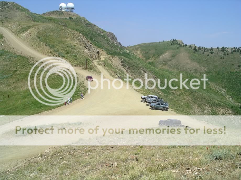
This pic was one of them
347745646%7Ffp64%3Dot%3E2334%3D%3C8%3A%3D324%3DXROQDF%3E2323797986462ot1lsi

I was back up there today and its amazing how close it is to the same 40 some odd years later
FrancisPeak008.jpg
 
Aside from bigger trees, one less road off to the left, and the addition of Dopler radar towers, it does look well preserved.
 
DrMoab said:


Looks like the little road (path?) that went up the middle of the hill was a lot of fun...

A shame its gone...

What's the deal with the gate?

Private Access now?

:dunno:
 
Didn't take long for the mountain to repair itself.
Pictures like that, show how easily most of our
wheeling isn't a permanent mark on Earth.
Basically, blowing up Sierra Club's theory about us.
 
Gil BullyKatz said:
Looks like the little road (path?) that went up the middle of the hill was a lot of fun...

A shame its gone...

What's the deal with the gate?

Private Access now?

:dunno:

Might have something to do with the radomes up there.

Rev
 
Actually the Domes were there in the first pic. You just can't see them from the angle of the pic.

Not sure about the road in the middle. If you knew where it went you would understand it couldn't go anywhere. Its a cliff.

The gate came about right after 9-11. Before that you could drive right to the door of the towers.

It is the controlling towers for 4 or 5 western states Aviation. I doubt they would want anything to happen to it.

People used to hang glide right from the cliff the towers sit on. Too bad they closed it down.

Here is a shot from the other side.
FrancisPeak029.jpg


It's kind of a cool place. 10,000 feet above SLC and you can look right down on the City while you are driving.
FrancisPeak030.jpg


Too bad the haze was so bad from all the fires today. It is normally quite a view.
 
I believe I would be looking at the road.That ditch to the right looks awful deep(10,000 ft).
Wayne


DrMoab said:
Actually the Domes were there in the first pic. You just can't see them from the angle of the pic.

Not sure about the road in the middle. If you knew where it went you would understand it couldn't go anywhere. Its a cliff.

The gate came about right after 9-11. Before that you could drive right to the door of the towers.

It is the controlling towers for 4 or 5 western states Aviation. I doubt they would want anything to happen to it.

People used to hang glide right from the cliff the towers sit on. Too bad they closed it down.

Here is a shot from the other side.
FrancisPeak029.jpg


It's kind of a cool place. 10,000 feet above SLC and you can look right down on the City while you are driving.
FrancisPeak030.jpg


Too bad the haze was so bad from all the fires today. It is normally quite a view.
 
Back
Top