Well, a select few of us retards decided to meet up in Big Bear to locate/run Mottino Wash (also known as the Sidewinder trail). Cal, James, Tito & Stephen (the Phillipino assassins) and myself had planned to go this weekend for quite some time but it turned out to be hotter than $%^& up there.
To aid in our search we had a general map of the area, an overheating GPS and two GPS coordinates. It took us about an hour and a half to locate the first coordinate but after searching the area, and about a ½ mile hike, we determined that this spot didn’t add up to the pictures and descriptions we had seen. We chose to continue on to the second coordinate.
After about another ½ hour of driving fire roads we came across the second coordinate. We quickly realized that meeting in Big Bear was sort of stupid and we should have gotten there from the 247 as the coordinates seemed WAY closer to Johnson Valley’s Boone Road than it was to Big Bear.
We all parked and we quickly hiked the trail which headed out off (northeast) of Rattlesnake Canyon. The talk on line had said it was similar to Sledge Hammer in its ‘trail type’ fit the bill as did some of the pictures we had checked out.
We proceeded to head on in. We left the Assassin’s FJ cruiser aside while we took Cal’s XJ thing, James’ XJ and my MJ through the trail.
Overall the trail seemed fine. There were quite a few rock obstacles. Definitely more technical compared to John Bull but not quite a Sledgehammer but the scattered rock layout sort of visually reminds me a tad of Sledge. I would say it is 20% easier than Claw Hammer as well. We had no real carnage other than the sole of my shoe came off thanks to the heat. James was getting quite the work out with the stick shift and his starter was doing overtime but he got through with the occasional ‘tug’. Cal and I took a couple of optional lines that tested the belly pan clearance of our large rigs. It was a fun run but the drive out there was a little much. I think I would consider it again if I were to come from the 247 side and if it was a bit cooler out there.
The big question is…………is this the actual Mottino Wash trail? We don’t really know. If not what trail was this?
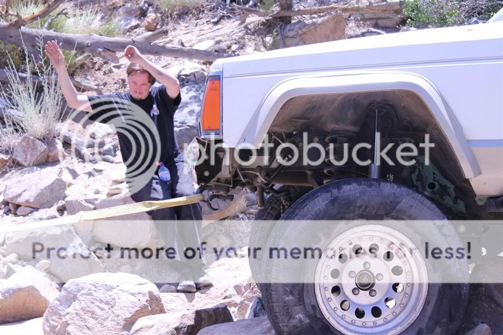
And the pictures (thanks to Tito):


To aid in our search we had a general map of the area, an overheating GPS and two GPS coordinates. It took us about an hour and a half to locate the first coordinate but after searching the area, and about a ½ mile hike, we determined that this spot didn’t add up to the pictures and descriptions we had seen. We chose to continue on to the second coordinate.
After about another ½ hour of driving fire roads we came across the second coordinate. We quickly realized that meeting in Big Bear was sort of stupid and we should have gotten there from the 247 as the coordinates seemed WAY closer to Johnson Valley’s Boone Road than it was to Big Bear.
We all parked and we quickly hiked the trail which headed out off (northeast) of Rattlesnake Canyon. The talk on line had said it was similar to Sledge Hammer in its ‘trail type’ fit the bill as did some of the pictures we had checked out.
We proceeded to head on in. We left the Assassin’s FJ cruiser aside while we took Cal’s XJ thing, James’ XJ and my MJ through the trail.
Overall the trail seemed fine. There were quite a few rock obstacles. Definitely more technical compared to John Bull but not quite a Sledgehammer but the scattered rock layout sort of visually reminds me a tad of Sledge. I would say it is 20% easier than Claw Hammer as well. We had no real carnage other than the sole of my shoe came off thanks to the heat. James was getting quite the work out with the stick shift and his starter was doing overtime but he got through with the occasional ‘tug’. Cal and I took a couple of optional lines that tested the belly pan clearance of our large rigs. It was a fun run but the drive out there was a little much. I think I would consider it again if I were to come from the 247 side and if it was a bit cooler out there.
The big question is…………is this the actual Mottino Wash trail? We don’t really know. If not what trail was this?
And the pictures (thanks to Tito):