• Welcome to the new NAXJA Forum! If your password does not work, please use "Forgot your password?" link on the log-in page. Please feel free to reach out to [email protected] if we can provide any assistance.

4 day Death Valley off-road route

travisk

NAXJA Forum User
Location
Fullerton, CA
I just got back from a four day roll through Panamint Valley and Death Valley and figured I'd share the route that I planned out for anyone else looking to explore this amazing piece of wilderness on back roads and 4x4 trails.

I took 8 vehicles through about 400 miles total with only one flat tire. We had to move fairly quickly to make all of these stops but we had a great time on a variety of terrain. If anyone has any other interesting parts that we missed, I'd love to hear about them.

Saturday 9:00 AM - Meet at the Mobile station in Olancha, just south of CoSo Junction (395/190).

Day 1 Start: Darwin Ghost Town (WP0059) 9:30 am (5.7 miles down Olancha Darwin Road from Hwy 190)
Day 1 Route = Darwin Loop ->Panamint Valley Road -> Indian Ranch Road -> Goler Canyon

  • Darwin Loop (approx 30 miles) - Difficulty: Easy - Moderate
  • Town of Darwin
  • China Garden Spring
  • Panamint Springs - FUEL UP
  • Ballarat Ghost Town
  • Goler Canyon
  • Lotus Mine
  • Newman Cabin
  • Barker and Myers Ranch - Lunch
  • Carl Mengel's Grave
  • Mengel's Pass - Difficulty: Difficult / Moderate
  • Russell Camp
  • Mengel Cabin Greater View Spring
  • Geologist's Cabin
Camp somewhere in Butte Valley or continue down into the canyon if it’s too cold.

Sunday
Depart @ 8:00 am
Day 2 Route = Warm Springs Canyon -> Warm Springs Canyon Bypass -> West Side Road -> Echo Canyon

  • Continue from Butte Valley
  • Warm Springs Mine
  • Big Talc Mine
  • Number 5 Mine
  • Grantham Mine
  • Artists Palette Loop
  • Furnace Creek - REFUEL
  • Zabriskie Point (time permitting)
  • Echo Canyon (10 miles) - Difficulty: Difficult
  • Inyo Mine / Schwaub Ghost Town (located on Echo Canyon) and Lees Ghost Town (Time permitting)
  • Pass through Echo canyon into Nevada.
Camp near Lees Ghost town.


Monday
Depart @ 8:00am
Day 3 Route = Echo Canyon -> Daylight Pass Cutoff -> Titus Canyon -> Ubehbe Crater -> White Top Mountain

  • Head through Nevada desert towards highway 95
  • Beatty - REFUEL
  • Titus Canyon (27 miles) - Difficulty: Easy
  • Ubehebe Crater (10 miles)
  • Teakettle Junction (25 miles)
  • Lost Burro Mine
  • White Top Mountain (13.2 miles)
  • The Racetrack
  • Lippencott Grade

Camp near mines halfway down Lippencott Grade or at the bottom in Saline Valley.

Tuesday
Depart Lippencott Grade @ 8:00 am
Day 4 Route = Lippencott Grade -> Hunter Mountain

  • Around Hunter Mountain
  • Lippencott Grade
  • Mines
  • Return to Hwy 190

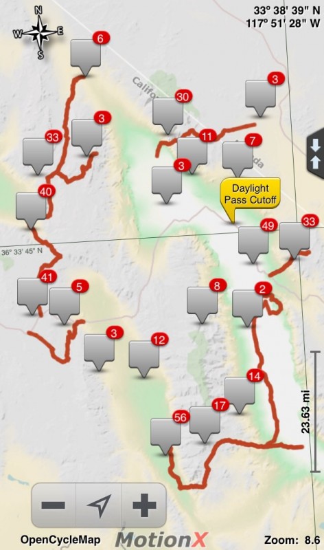
I have Google Earth and Gpx files if anyone is interested. The route makes a counter-clockwise loop starting at the far west edge of this map.
normal_image~215.jpg


This route was planned primarily using the book "Death Valley SUV Trails" by Rodger Mitchell.
 
Here are a few pics.

normal_IMG_6130.JPG

Darwin Loop

normal_IMG_6180.JPG

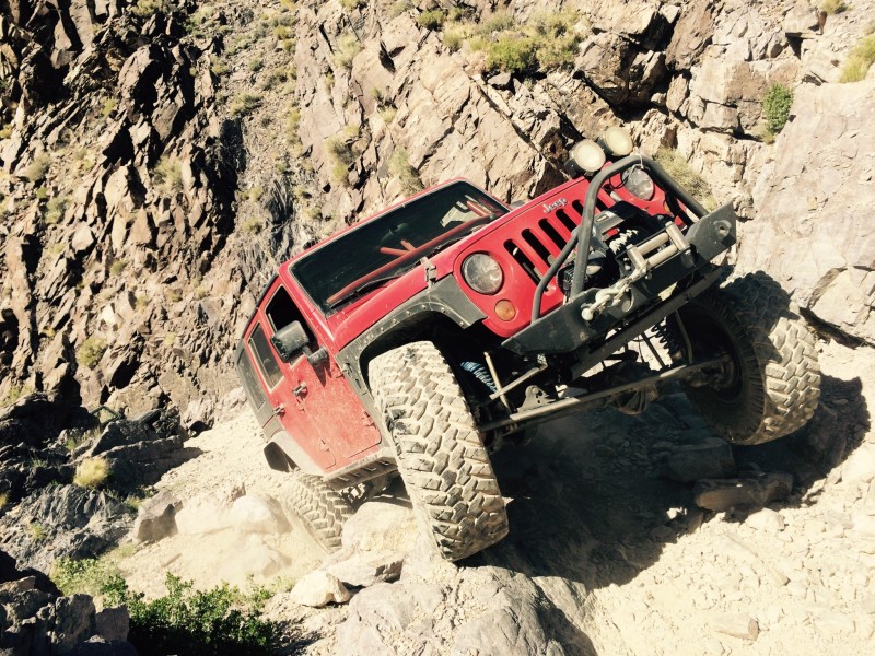
My dad coming down Mengel Pass

normal_IMG_6194.JPG

Butte Valley

normal_IMG_6237.JPG

Eagle Borax Works

normal_image~216.jpg

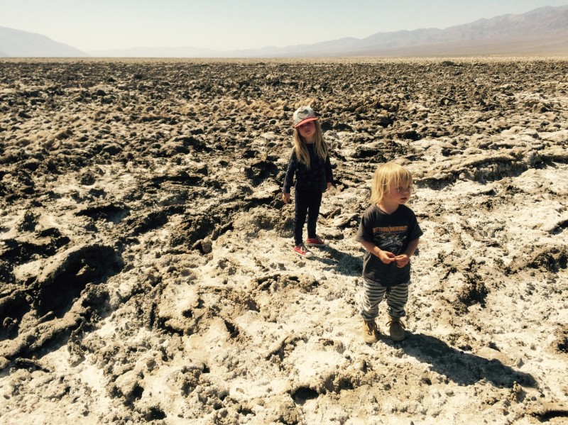
Devil's Golf Course

normal_image~214.jpg

Echo canyon

normal_IMG_6282.JPG

Land Cruising

normal_image~217.jpg

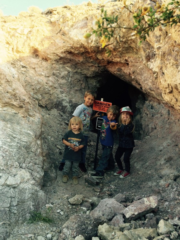
A mine

normal_IMG_6338.JPG

Down Titus Canyon

normal_IMG_6361.JPG

Titus Canyon

normal_IMG_6445.JPG

Rattlesnake at the Racetrack Playa

normal_IMG_6483.JPG

Lippencott Grade campsite
 
Very nice. I did a "day trip a couple weeks ago from rancho cucamonga and back including darwin, China gardens, panamint, death valley, racetrack, lippencott, saline valley north to big pine, then back home. 2am-10pm. Shoulda been a two day. Maybe this summer I'll try your 4 day route...my ac works.
 
I did a "day trip a couple weeks ago from rancho cucamonga and back including darwin, China gardens, panamint, death valley, racetrack, lippencott, saline valley north to big pine, then back home. 2am-10pm.


Wow, that's a long haul. I've found the temps in Death Valley to be reasonable in April, although it's best to camp at the right altitude. 0' is too low, 5,000' is too high. 2,500' is just right.
 
That's quite an itinerary. I've explored that area a little, but definitely want to go back and check out a few more of those spots. Awesome looking trip!
 
How difficult is Echo canyon?
What do think are the minimum rig requirements?
 
Think a stock height Cherokee could do it?
 
Nice trip, Travis. You indeed covered quite a bit of ground on that.

Too bad I didn't know you were going. My son, Noah, is now out at PSR working. HE got out there about two weeks ago.

I'll be out there May8th-11th, in case anyone wants to join. Will be doing days runs out of PSR on Saturday and Sunday. I could use an extra seat and vehicle for safety, and comfort of my friends that will be out there with me.

David Bricker / SYR
 
Travis, I know you rated Titus Canyon as easy. and I've been down it a dozen times. On May 8th, I'm coming into DV from Lost Wages. I plan to run Titus, since we're in the general vicinity and the other three folks have never been. I'm aware of the normal maintenance Titus gets to keep dumb tourists out of trouble.

Well, I plan on being one of those dumb tourists. I have a full size (by rental car definitions) car rented to get to PSR and get out Gomer. I'm curious about current conditions. Easy in an J is a lot different than easy in a car. Do you see any issue in getting a full size, like a Malibu, through Titus at this time? I know conditions can change in an instant. PSR will also know that if I don't show up by 7:00pm, to come looking for me. We of course, will have water and snacks, but I wasn't planning on buying a flat repair kit.

David Bricker / SYR
 
I'm curious about current conditions. Easy in an J is a lot different than easy in a car. Do you see any issue in getting a full size, like a Malibu, through Titus at this time?

The road through Titus Canyon was fairly well groomed, if I recall. You shouldn't have any problems.

The road to Teakettle Junction, on the other hand, was washboarded to hell and would be painful to drive on in a sedan (but that didn't stop some very lost Japanese tourists from trying.)

They were actively grading roads in both Panamint and Death Valley while we were there.

We didn't stop in Panamint Springs for more than a few minutes to top off our gas tanks and check out the general store, but it seems like a nice place.
 
Thanks for the quick response. I appreciate the assurances. Generally, if Titus is bad enough that it will get a tourist stuck, they'll close the gates, but it's nice to hear a recent report.

What you missed at PSR, besides my son and Gomer, was 13 beers on tap and over 180 in bottles in the cooler. That, along with some very good burgers, pizza and salads, and the view at sunset from the front porch, can make for a quite relaxing experience. Especially since your cell phone won't work out there.

I have heard an unconfirmed rumor that the Park Service is going to let the Racetrack Rd. deteriorate on it's own into a backcountry road, in an effort to reduce the number of issues created by badly lost tourists getting into trouble out there. I'm not convinced that if this is true, that it will reduce the number of tourists. Too many maps, and too many reports eist on the intardnet that describe it. We've already seen tourists happily try to go down trails that have been in no condition for passenger cars for decades.

David Bricker / SYR
 
Back
Top