• Welcome to the new NAXJA Forum! If your password does not work, please use "Forgot your password?" link on the log-in page. Please feel free to reach out to [email protected] if we can provide any assistance.

Location Change Poll

Status
Not open for further replies.
*Update on Table Mesa as of today 3/27.

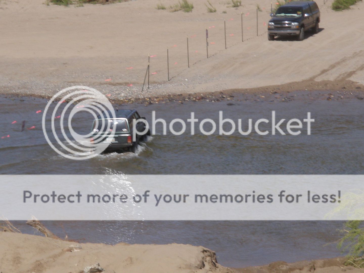
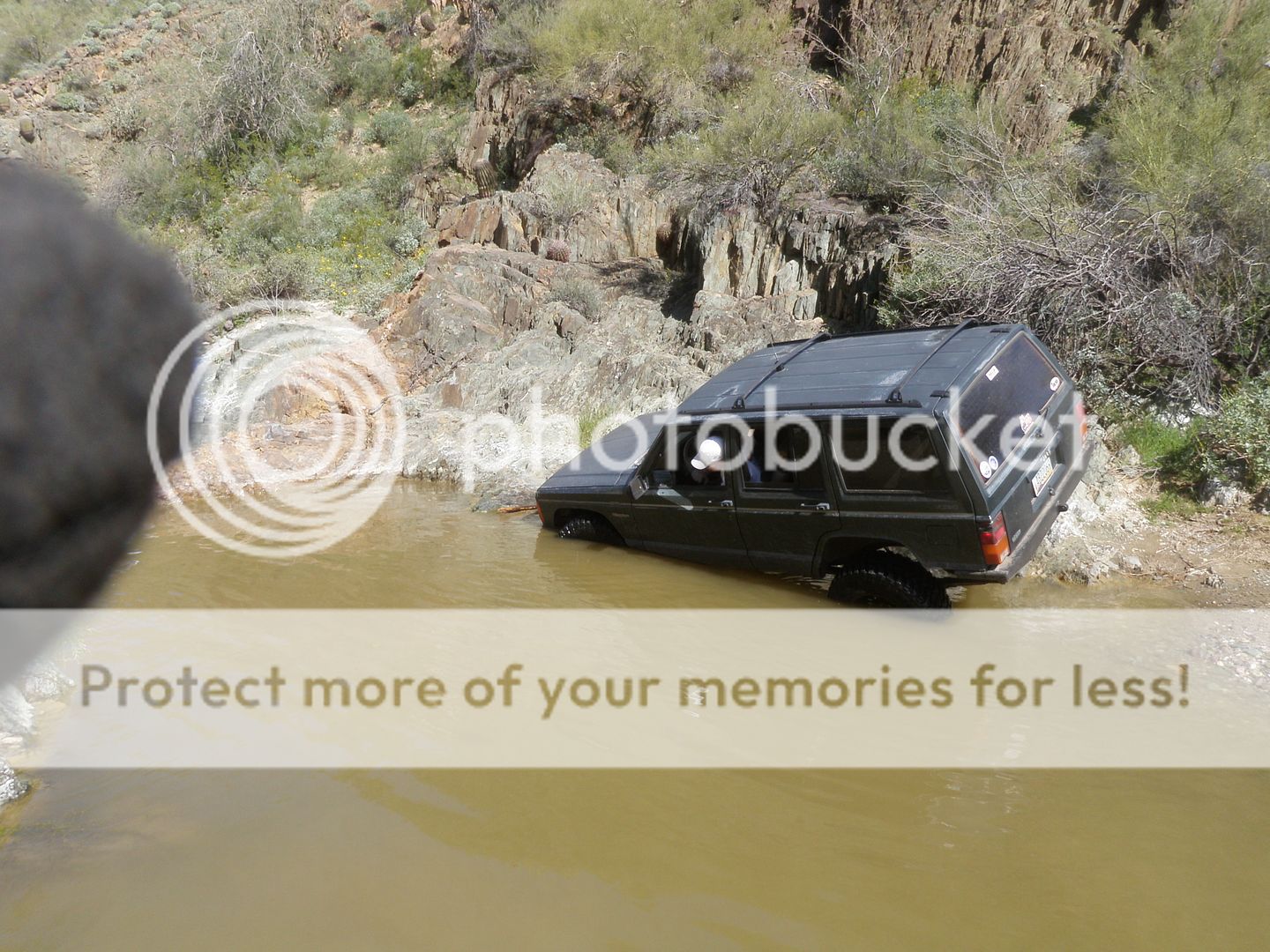
Just got back from a short trip up to TM. Pulling up to the main crossing we found a boatload of parked jeeps and offroaders wanting to cross and yet also rethinking that decision. There was a lifted blazer stuck similar to the pic of the whit Cherokee posted on here previously. Im not saying that becuase of that we shouldnt go. The driver, well he seemed to be "slower" then the average wheeler and well lets just say there was alotta laughing going on when the Motor Grader had to come and pull him out. The river is still crossable as I crossed fine with 33s and there were several Rhinos and Razr's crossing as well. Coming back we saw a stock Chevy 2500 cross no problem either.

The real problem is that once you cross the road that veers to the right or north where all the trails are at is fenced off. I got to talk to one of the owners, very nice guy(operating the motor grader), plans on building some sporadic housing throughout the area to the north and that the entire are will be closed starting in May He also said that depending upon how respectful we are to the land and fenced off areas he plans on reopening the area in the future to allow access to the trails to the north.

Heres some pics of the blazer:


To the left of where the blazer is stuck is crossable or we can get in from the back way(about the same distance and the one necessary crossing is even easier than the main one here. There's just no where to go once we get in there. So even though i was adamant about keeping it at TM before it looks like switching to Florence is our best option.

Sean.
 
The road that leads back to LT and other trails in that neck of the woods is on BLM land and cannot be closed by anyone other than the BLM... If you are talking about the river bottom leading to DS and the actual trials of CD1 and 2 in addition to gillett and running the river you would be correct... The trails that are planned are not on the private property and access to them can't be legally closed if the owner has closed off the road going to the right he would be violating the law it's not his land to close...

themud
 
Im not sure where the trails you guys run are located this will be my first event up there with you guys. But from my understanding the majority of the trails i thought were just past that crossing and up to the north or the right? which as of today is completely closed and fenced off. the trails themselves are not closed only the roads to access them. from talking to other jeepers out there today the only way to access the "good trails" right now as one of them said was to come in from the north near crown king area.

90acres were just bought about a month ago by the guy in the grader and he is closing it off and plans on having it permanently closed by may.
 
So is it official? Florence?

Ill be up there Friday night with the Land cruiser, Ill be taking a group up to Martinez cabin Saturday. Any Cherokees can tag along. I think well head out at like 9am-10am.
 
Gasman, CrashSomers, myself and a couple of others ran LT today. There's water to cross and there's water on the trail, but didn't stop us. I'll post pics as soon as they upload.

Rockfest will be at TM.

As for the guy with the grader, we talked with him for quite a while this morning. Nice guy. He's just trying to protect what's his the same as any of us would do. He was willing to discuss allowing NAXJA access to DS and CD for Rockfest. I will be in contact with him prior to Rockfest.
 
The river was running, the trail had water in it. A TJ and Yoda ran with us. LT was a wet trail but not difficult. Note to self: spinning metal shafts and rocks do not play well together.
A TJ from another group blew up his tcase trying to pull me off a rock after the ds split.

The cage took a hit, dented the tube, but no body damage (this time :) )

Here's the link to all the pics: http://s258.photobucket.com/albums/hh267/jporvaz/20100328_TM_LT prerun/

Some teasers:
P3280006.jpg


P3280013.jpg


P3280015.jpg


P3280027.jpg


P3280050.jpg
 
Pics look awsome. I cant wait to run TM. Soon baby soon.
 
Im not sure where the trails you guys run are located this will be my first event up there with you guys. But from my understanding the majority of the trails i thought were just past that crossing and up to the north or the right? which as of today is completely closed and fenced off. the trails themselves are not closed only the roads to access them. from talking to other jeepers out there today the only way to access the "good trails" right now as one of them said was to come in from the north near crown king area.

90acres were just bought about a month ago by the guy in the grader and he is closing it off and plans on having it permanently closed by may.

There's 3 known trails affected by this. Dirty Sanchez, Collateral Damage, and Twisted. All 4+ trails. Twisted is entirely on the property. Only the entrance to CD and DS is on the property. CD is really 2 trails, CD1 and CD2 with CD2 being a notch harder than CD1. CD2 can be accessed by going down the CD1 exit road, then up CD 2. You can also run CD1 and Dirty backwords and turn around at the entrance but each one has a waterfall to go down that makes it a bit hairy. That's all on BLM land. Yes, they are good trails but there's many others still accessable. Hopefully we can gain access back to at least CD an DS down the road but we'll see.
 
Well Im glad to hear its still gonna be at TM. And excited for the trip so I can finally learn of the locations of all the trails.
 
Gasman, CrashSomers, myself and a couple of others ran LT today. There's water to cross and there's water on the trail, but didn't stop us. I'll post pics as soon as they upload.

Rockfest will be at TM.

As for the guy with the grader, we talked with him for quite a while this morning. Nice guy. He's just trying to protect what's his the same as any of us would do. He was willing to discuss allowing NAXJA access to DS and CD for Rockfest. I will be in contact with him prior to Rockfest.

OHHHHH SWWWWWEEEEEEETTTTTT DS is so calling my name AGAIN and CD just has to be run...

themud
 
There's 3 known trails affected by this. Dirty Sanchez, Collateral Damage, and Twisted. All 4+ trails. Twisted is entirely on the property. Only the entrance to CD and DS is on the property. CD is really 2 trails, CD1 and CD2 with CD2 being a notch harder than CD1. CD2 can be accessed by going down the CD1 exit road, then up CD 2. You can also run CD1 and Dirty backwords and turn around at the entrance but each one has a waterfall to go down that makes it a bit hairy. That's all on BLM land. Yes, they are good trails but there's many others still accessable. Hopefully we can gain access back to at least CD an DS down the road but we'll see.

has anyone contacted BLM and notified them of someone prohibiting access to BLM property? a :phone: might be in order to assist the property owner in realizing the legal aspects of blocking access to public lands...
 
He is not stoping anyone from getting to BLM land. He is just keeping peps off his land with the help of the po po. since a group of wheelers were out there running over his signs right in front of him and pulled a gun on him. BLM is open the road is passable but you can no drive on his land.
 
This is the situation at present, as I understand it, concerning the property: The path we normally use to access a few trails(river bed, DS, CD1, CD2, Twisted) is on private property. The owners have made plans to make some improvements in the area. They have been working with BLM for a long time and have provided access across the river, through their property so that the road can remain open and folks can continue to enjoy the land on the other side of the river. They had posted signs asking that people respect their property and not drive through certain areas due to their plans- primarily the path to the trails listed above). The signs were disregarded, run over, and the owners were completely disrespected. The owners did what they thought they needed to do to protect their property. The owners are not anti-offroader but the offroaders are making it hard for them.

Several groups have been in contact with the owners concerning the same issues and in each case the owners have been open to discussions. The problem is that those who refuse to respect the private property are forcing the owners to take to a "no access" attitude. We, as responsible users, should try to be a part of the solution and not a part of the problem.

All the trails that are normally run in the TM area which will be used for Rockfest are easily accessible. I will be in contact with the owners as to the possibility of having DS and CD accessible for this event.
 
Basically from talking to the owner on saturday i got the same impression. Glad you got him to allow us access to the road for rockfest!
 
So far he hasn't allowed anything other than the crossing of the river by use of the main road. He is willing to discuss providing access to the trails. I'll be working on it.
 
:worship:I am closing this thread. The location change discussion is over.:woohoo:

See you all at TM.:cheers:
 
Status
Not open for further replies.
Back
Top