• Welcome to the new NAXJA Forum! If your password does not work, please use "Forgot your password?" link on the log-in page. Please feel free to reach out to [email protected] if we can provide any assistance.

Splinter's Cabin / Deep Creek / Dishpan Springs area open

GSequoia

Everyone says I'm a jerk.
NAXJA Member
Location
Torrance, CA
US Forest Service said:
Forest Roads 3N34 / 3N34C and OHV Trail 3W12 are open to the public. As you are aware, This area suffered considerable damage during the Old Fire in October 2003, killing a significant amount of trees. Over the past several months, logging crews have been removing trees that posed a hazard to the road network.
 
not that I'll be able to chck it out anytime soon, but where is that? near BB?
 
I told you so.


:D
 
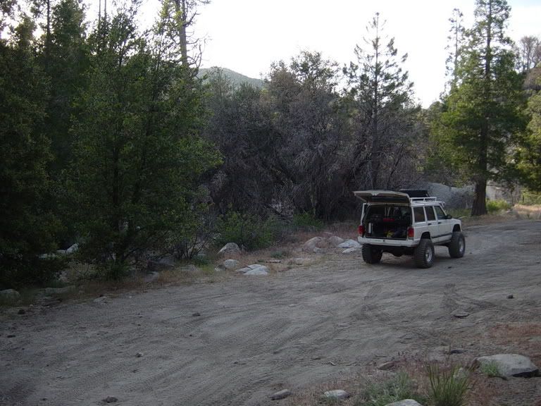
OPEN? Yes open, not just another tease or bit of misinformation. I went up Sunday to check things out. Because of being up until 8 am Sunday morning, thanks to Calico don't you know, I got a late start. I finished airing down just before 7pm at the staging area just across the T6 crossing.
DSC02956.jpg


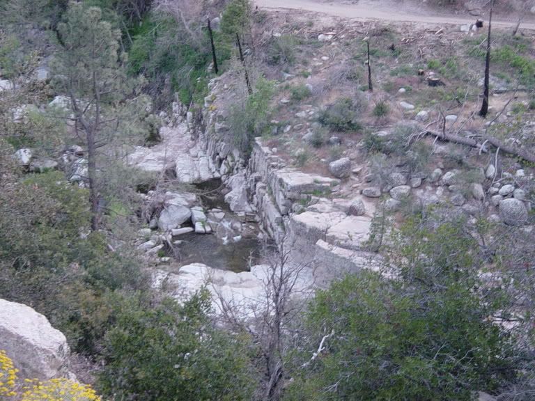
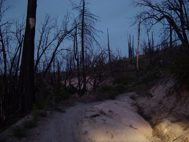
Heading in, the area is still a mess from the beetle abatement but once you get down near the creek the effects of the fire is what you notice. The Aspen along the banks appear to have not taken to much of a hit, at least in this area. The wild flowers are heavier than they were prior to the fire, a couple of more seasons and they will have taken over the forest floor.
DSC02966.jpg


The trail shows the effects of the fire two ways. One is obviously the damage to the plant life, which in turn has allowed for run off to make its mark on many areas of the trail itself. The first turn after the crossing has more loose and/or taller rocks having caused traffic to hug the outside line :cough pansies:. Unlike before the rocky area extends another 35+ yards beyond the face climb on the back side of the bend.
DSC03002.jpg
http://i9.photobucket.com/albums/a90/TBentley/DSC03002.jpg

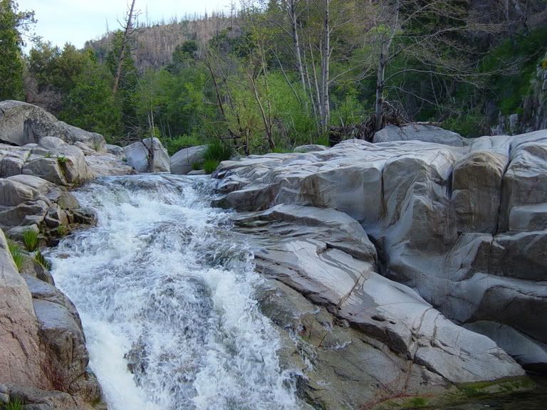
Looking down to the creek near the top of the first ridge.
DSC03003.jpg


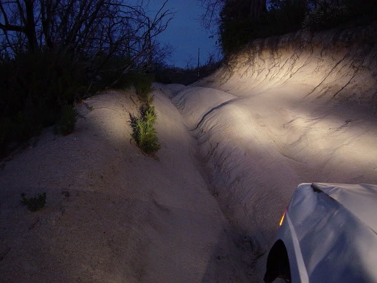
There are many new ruts running down the trail
DSC03011.jpg


Exiting ruts have grown, some (not shown because of darkness) have grown enough so swallow some rigs. There are turns that have had the down hill half washed out completely.
DSC03016.jpg


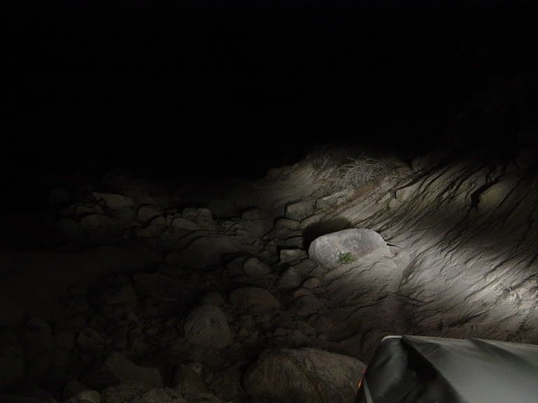
The main attraction, the "waterfall" still has the same two primary lines. The bottom of the climb, down at the turn has many more exposed rocks in various flavors.
DSC03026.jpg


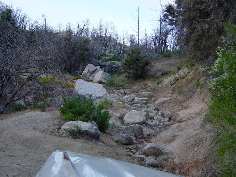
As you can clearly see in the photograph below,if you choose to dogleg right to left midway up the climb to the rock face, there in a new and improved canyon to get around or through.
DSC03023.jpg


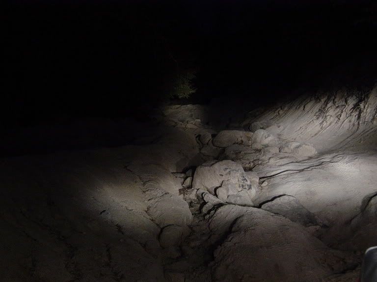
I got as far as the two rocks, shown just to right of center in the above photo when I had to rethink plan. I'm not exactly sure which, I rolled one up into my PS front brake line. I really didn't notice until I went to back up to try to get a little more to the right. The floorboard will surprise the snot out of a brake pedal, in the rocks, on a hill, in the dark, alone. :D

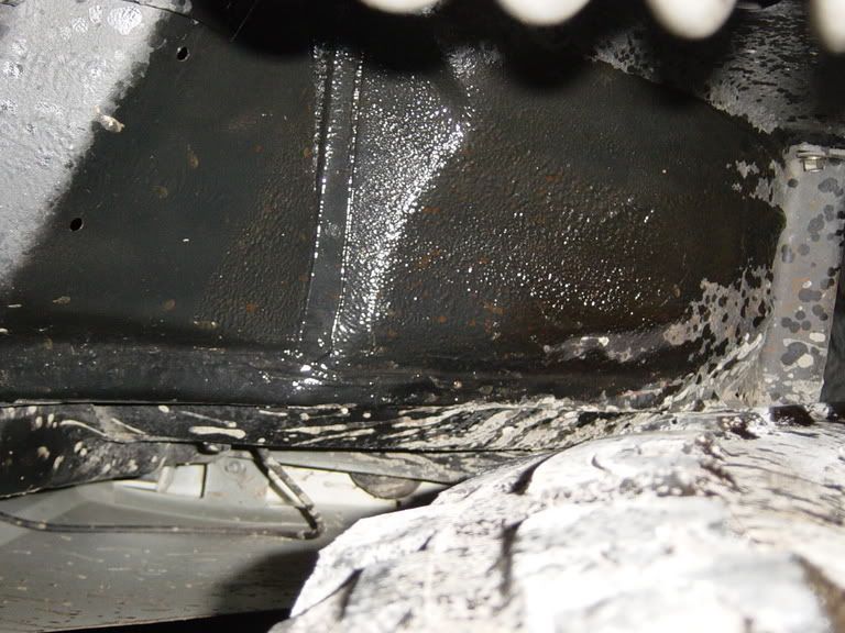
The inner fender offered up the second clue as to where things went awry.
DSC03029.jpg


It turned out that the hit only spun the brake line and retaining nut on the caliper. I was able to spin it back and retighten things without having to replace the copper washers; yes I had spares, I'm not entirely stupid.
After getting back down onto a flat area, I was able to get the line bled out (into a container), MC topped off and be ready to hit the trail again. After ten minutes of one on one debate with myself, consultation of my passenger, the map and GPS it was decided to turn around return another day for an assault on the hill. I was back on asphalt, reconnected and aired up by midnight; not bad, all things considered. Oh, there was also a brief conversation with a Sheriff who for some reason, looked at me rather strangely, hmmm, go figure.
:dunno:


TIM
 
Last edited:
Jump This said:
Well? Where the hell is this place?
:D
Rick R:sunshine:

This trail goes from the Lake Arrowhead area over towards Big Bear. I only know how to get the head of the trail through Lake Arrowhead. I have been wanting to run this for over 2 years! I am booked through most of June, but I want to make a day trip up there as soon as possible.
 
rpraterxj said:
This trail goes from the Lake Arrowhead area over towards Big Bear. I only know how to get the head of the trail through Lake Arrowhead. I have been wanting to run this for over 2 years! I am booked through most of June, but I want to make a day trip up there as soon as possible.

Maybe this will be "the" run on the 1st of july.... I love that trail...
 
Clean-RC said:
Maybe this will be "the" run on the 1st of july.... I love that trail...
I'll go with you
BTW, did your xj get any wrench time last weekend?
 
Clean-RC said:
Maybe this will be "the" run on the 1st of july.... I love that trail...

I am there! I may have Kaleb with me too.
 
I will do everything I can to be there...have to be sure money and time will be permissive since I'll be just arriving in CA a couple weeks prior
 
jonboy said:
I'll go with you
BTW, did your xj get any wrench time last weekend?

Yeah the Xj has been getting a bit of wrench time little by little all week... well except weds and thurs... I am yanking the tranny out today and hopefully installing the new one... Just plugging away, one task at a time....The list grows ever so slightly shorter....
 
Which way did you run it, west -east???, or East-west..

I am guessing you ran it from Hooks Creek road east.....

Let me know..

I am leading a group on that trail in a few months and trying to figure out the best way to approach it..
 
Yep, John, we should go up there 1st of july. me, You and maybe Wally can run it.. Mabe MIKE R can show up too .. I'll plot it out on the GPS..

sound good??
 
zjmikey said:
Which way did you run it, west -east???, or East-west..

I am guessing you ran it from Hooks Creek road east.....

Let me know..

I am leading a group on that trail in a few months and trying to figure out the best way to approach it..
I like west (from Hook Rd) to east so you're climbing
 
jonboy said:
I like west (from Hook Rd) to east so you're climbing

Same here.
 
Back
Top